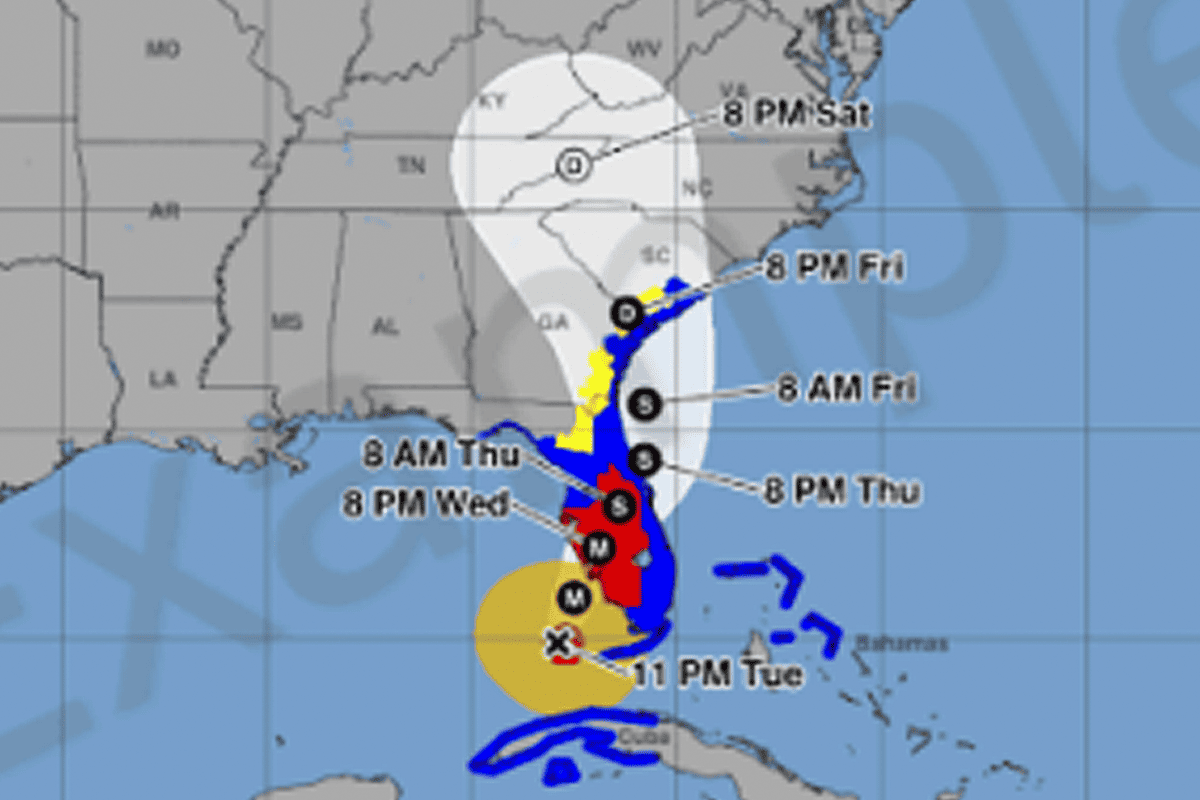
MIAMI – When the 2024 Atlantic hurricane season begins to kick up, the National Hurricane Center will implement an “experimental” new graphic for the tropical forecast cone.
The season begins on June 1 and runs through Nov 30. However, the center announced that the experimental version of the cone won’t be issued until “on or around” Aug. 15.
The new version will include tropical storm and hurricane watches and warnings in more inland areas, as opposed to merely costal areas.
The center said the changes are being made because of recent data indicating that a higher focus on inland wind risk “decreased focus on the storm track” and reemphasized focus on the potential dangers faced by wind.
The cone depicts all possible, likely areas where the eye, or center, of the storm can be located; that means that a large storm with strong, wide-reaching winds could impact plenty of inland areas.
The new cone could help observers better understand the kind of threat posed to their area, even if they aren’t located in a coastal area with a flood advisory, or if they are on the edge of the cone.
“Recommendations from social science research suggest that the addition of inland watches and warnings to the cone graphic will help communicate inland wind risk during tropical cyclone events while not overcomplicating the current version,” the center announced.
The center also said it will be listening to user feedback.
The National Hurricane Center releases cyclone advisories at 5 and 11 a.m. ET, and 5 and 11 p.m. ET. It said that with these timeframes, the new experimental graphic might not be released immediately with each advisory, but rather within around 30 minutes of each advisory.
It will continue to release the typically-expected forecast cone, and coastal watches and warnings will remain the same as they have been displayed.
Some graphic changes are also coming to the new cone: it will use a white shading for the full five-day forecast instead of the current dotted “stippling.” It will also be outlined in white.
In the new cone, the watches and warnings will be more prominent for the inland areas.
Source: flvoicenews.com


